
The valuation platform
Built for the way a reappraisal actually runs.
Revaluator isn't a general-purpose GIS tool with assessment bolted on. Every screen exists because a county needed it during a live revaluation — and most of them were shaped by the assessors using them. And every one of them works on a staging copy of the county's data, so the work can be done, checked and reviewed before anything is real.
NEW The property record
Edit the CAMA record, with the county's own rules behind it.
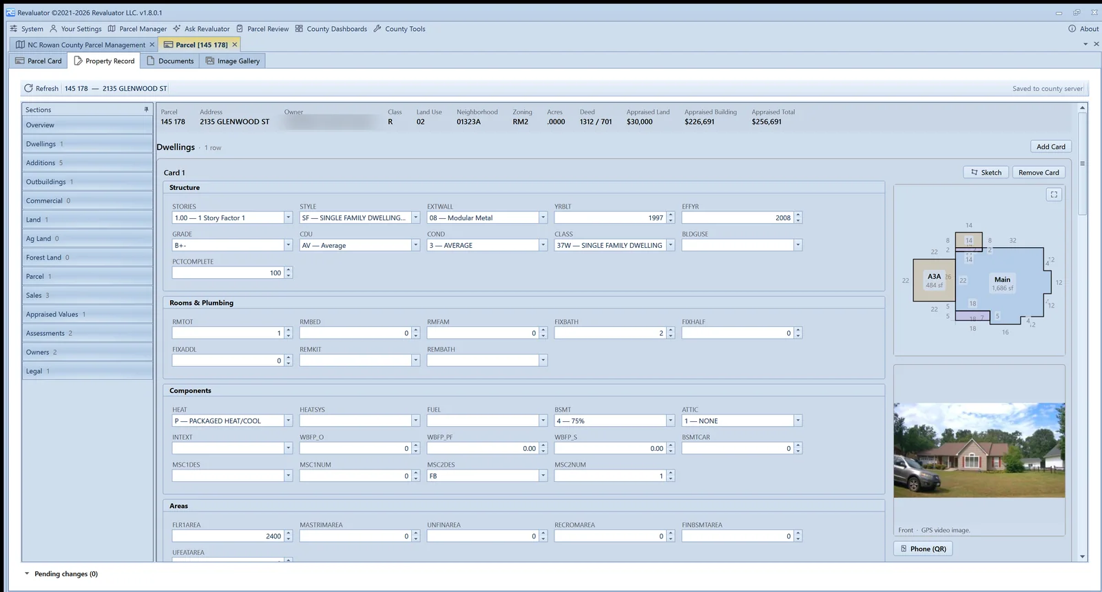
Where the CAMA system publishes a full extract, Revaluator loads it and opens the property record as an editor — a read-only band of the basics, then only what is editable: dwellings, additions, outbuildings, commercial sections, land. Every dropdown is the county's own code table. Every dollar stays locked; this is for correcting what the record says, not what it's worth.
- Add or remove cards and lines; new construction and percent complete are first-class
- Field checks learned from the county's data: unknown codes, out-of-range values, wrong types
- Every change highlighted, logged with who and when, and kept as a delta against the source
- Edits survive a fresh extract and travel with an offline bundle
Sketching
Redraw the footprint on a touch canvas.
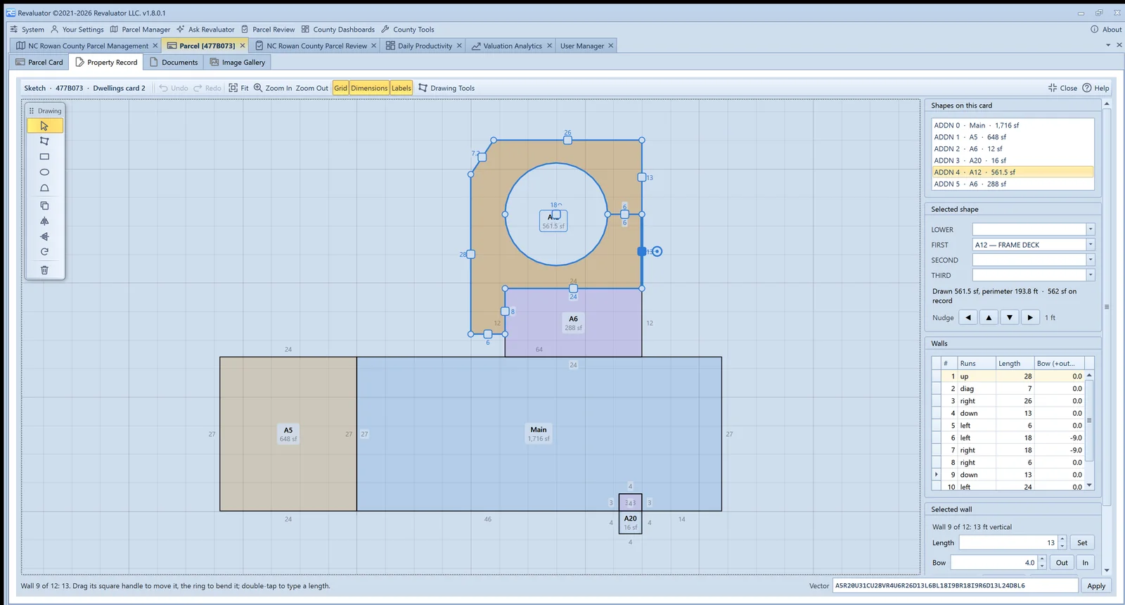
The sketch editor reads the CAMA's own vector strings — rectangles, diagonals, bows, ovals — and writes them back. Drag a wall and its neighbours stretch; drag a corner and the walls turn diagonal; pull the ring handle and the wall bends. Areas and perimeters recompute as you go.
- Select, draw, rectangle, oval and curve tools on a floating palette
- Type walls the way the CAMA spells them, or type a length onto a tapped wall
- Duplicate, flip, rotate, split and straighten; snap to other shapes' corners
- Drawn area checked against the area on record, per card
Valuation
Comparable sales that show their work.
Every value a county sets is a value a taxpayer can appeal, and the appeal turns on evidence. Comparable Sales finds qualified arm's-length sales, scores them, adjusts every price to the statutory valuation date — and shows every screen, weight and calculation, because the board hearing is where the work gets checked.
- Scored comps grouped by strength, with a per-comp report showing the arithmetic
- Time adjustment on a repeat-sales index built from the county's own paired sales
- Package sales, token prices and non-market deeds screened out and disclosed
- Printable comp sheets and appeal packs; one click sends the set to the sandbox

Valuation sandbox
Solve the land from the sales, one parcel per column.
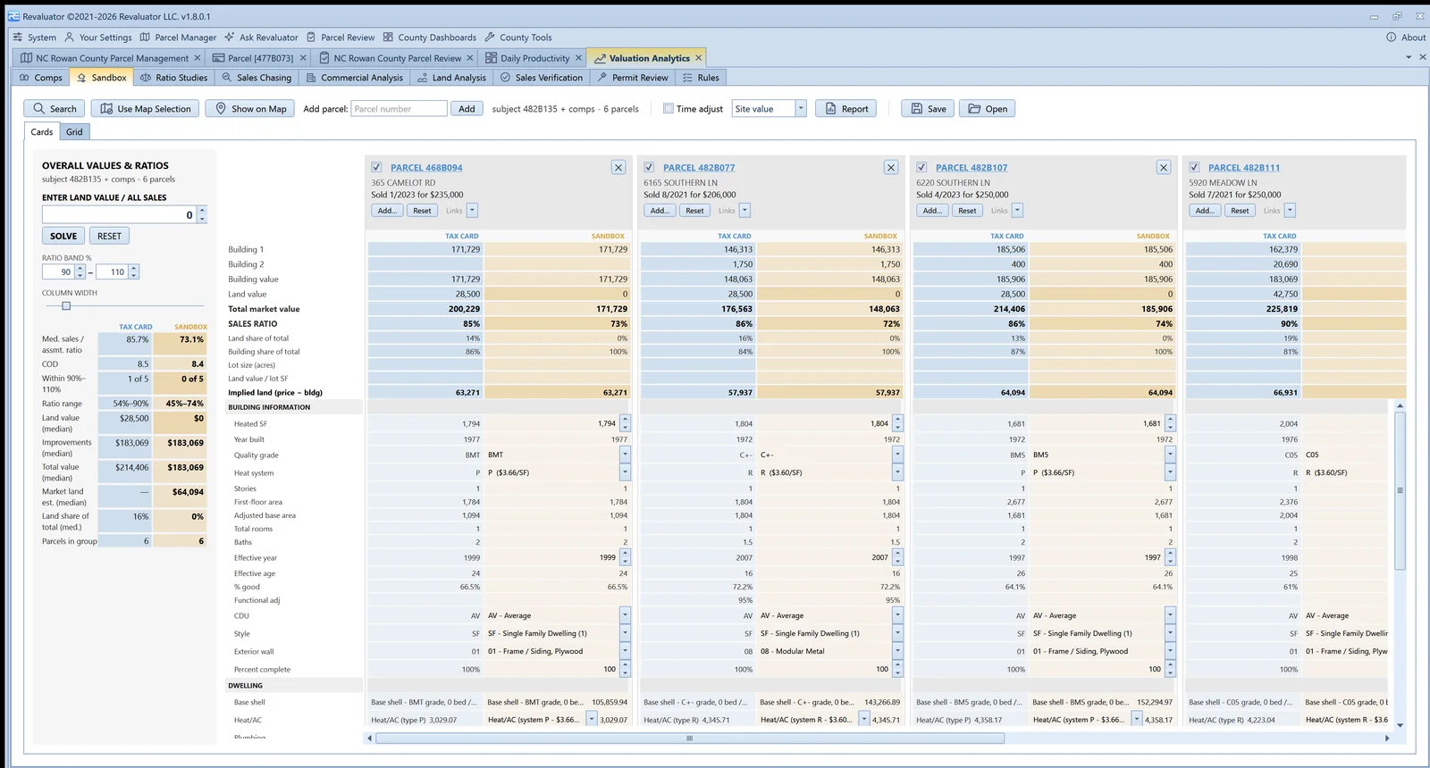
The sandbox is a land-abstraction workbench modelled on the spreadsheet an appraiser would build by hand. Improvements are frozen per parcel, priced exactly the way the county's cost tables price them; the land is the one dial for the group. Tax card and sandbox sit side by side for every parcel.
- Change grade, condition, effective year, heat, style or wall from schedules fitted to the county's own data — never a typed dollar
- SOLVE takes the median implied land across the included sales
- Ratios, COD and the share within the band update live on the rail
- Every edit snapshot-tracked; studies saved and reopened
Ratio studies & sales chasing
IAAO statistics, county-wide and by neighbourhood.
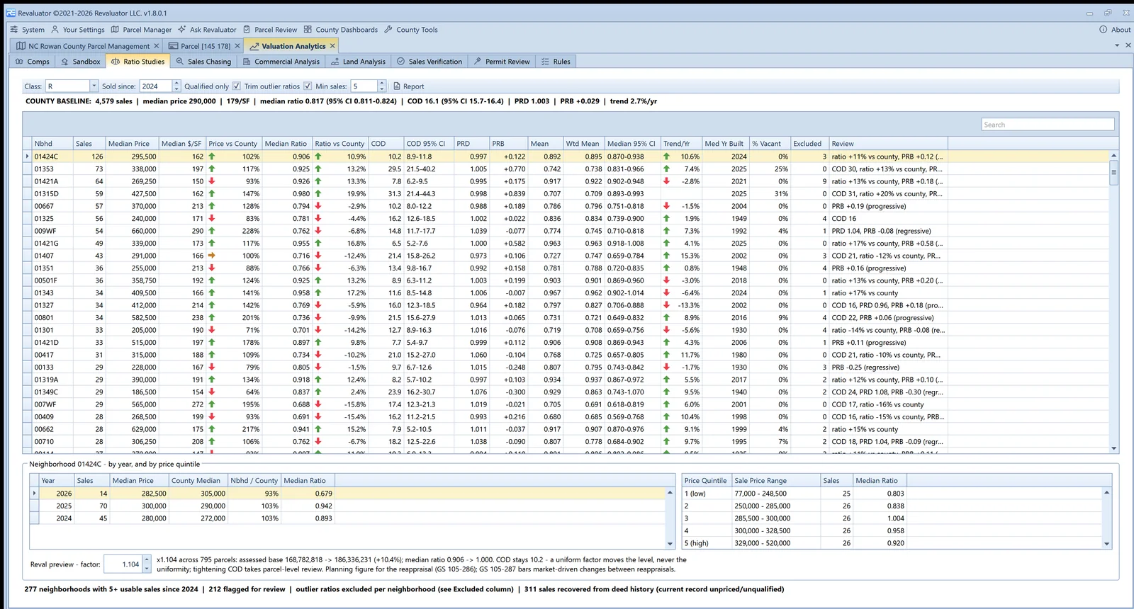
Ratio Studies gives every neighbourhood its median ratio, COD, PRD and PRB with confidence intervals, trend per year and a reval preview factor. Sales Chasing runs the IAAO hold-out and strata tests so the office can show the assessments weren't fitted to the sales.
- County baseline row, then every neighbourhood with a review note
- Sales before the valuation date against sales after it, with Mann-Whitney p-values
- Sold-versus-unsold value change once a prior roll is on file
- Commercial, land, sales verification and permit review tabs alongside
Map layers
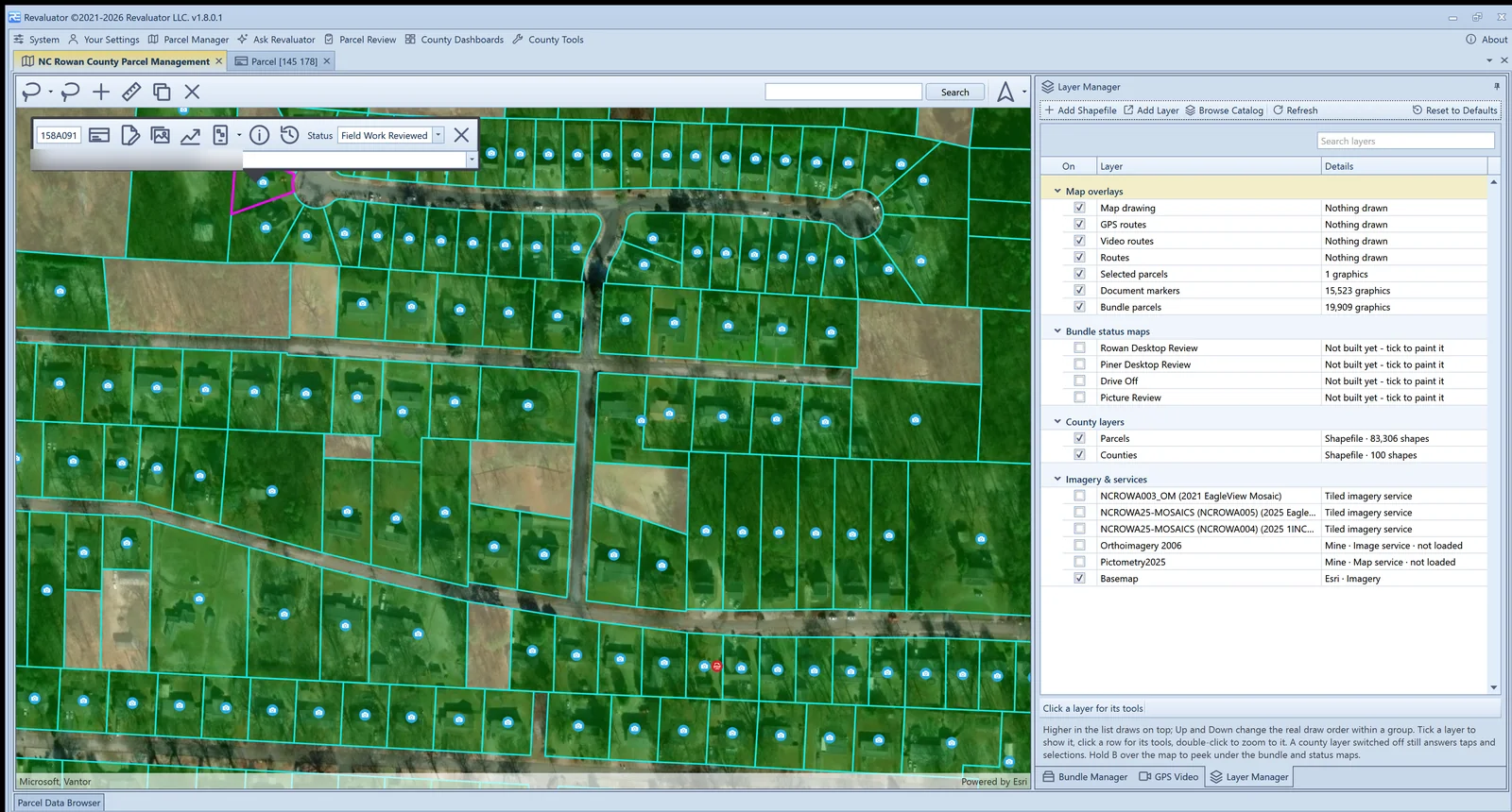
Every layer in one grid. Every source in one catalog.
The Layer Manager is a single grid grouped by kind — overlays, status maps, county layers, imagery and services — where the list is the draw order and the tools follow the row you click. The Layer Catalog is where new layers come from: your county's GIS server, your state's portal, ArcGIS Online, or a file on disk.
- Link a service where it lives, or download it for offline — both offered when both exist
- State portals seeded per state; county sources managed like any other setting
- Historic aerials, zoning, schools, flood zones, roads — whatever the publisher offers
- Features on a linked service are clickable, with the publisher's own popup fields
Layer catalog
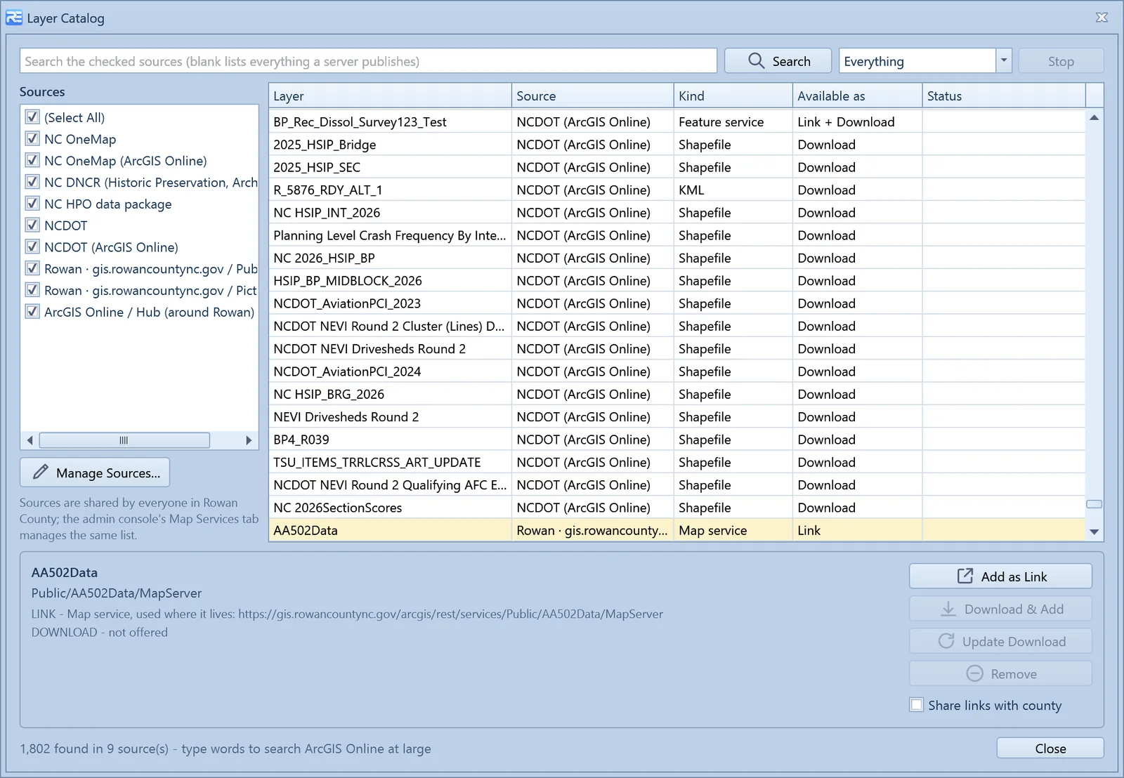
Browse what your state and county publish. Add what you want.
Pick the sources, search, and the catalog lists what each one offers — map services, feature services, shapefiles, KML — with how each is available. One click adds it as a link; another downloads it so it keeps working in the field. Updates are flagged when the publisher changes the file.
- North Carolina ships with NC OneMap, NCDOT and the state historic-preservation and archaeology data
- Any ArcGIS server, ArcGIS Online organisation, Hub site, feed or folder can be a source
- Downloads live in one folder per layer — remove the layer and its files go with it
- Admins share links county-wide; everyone else adds their own
Assignment
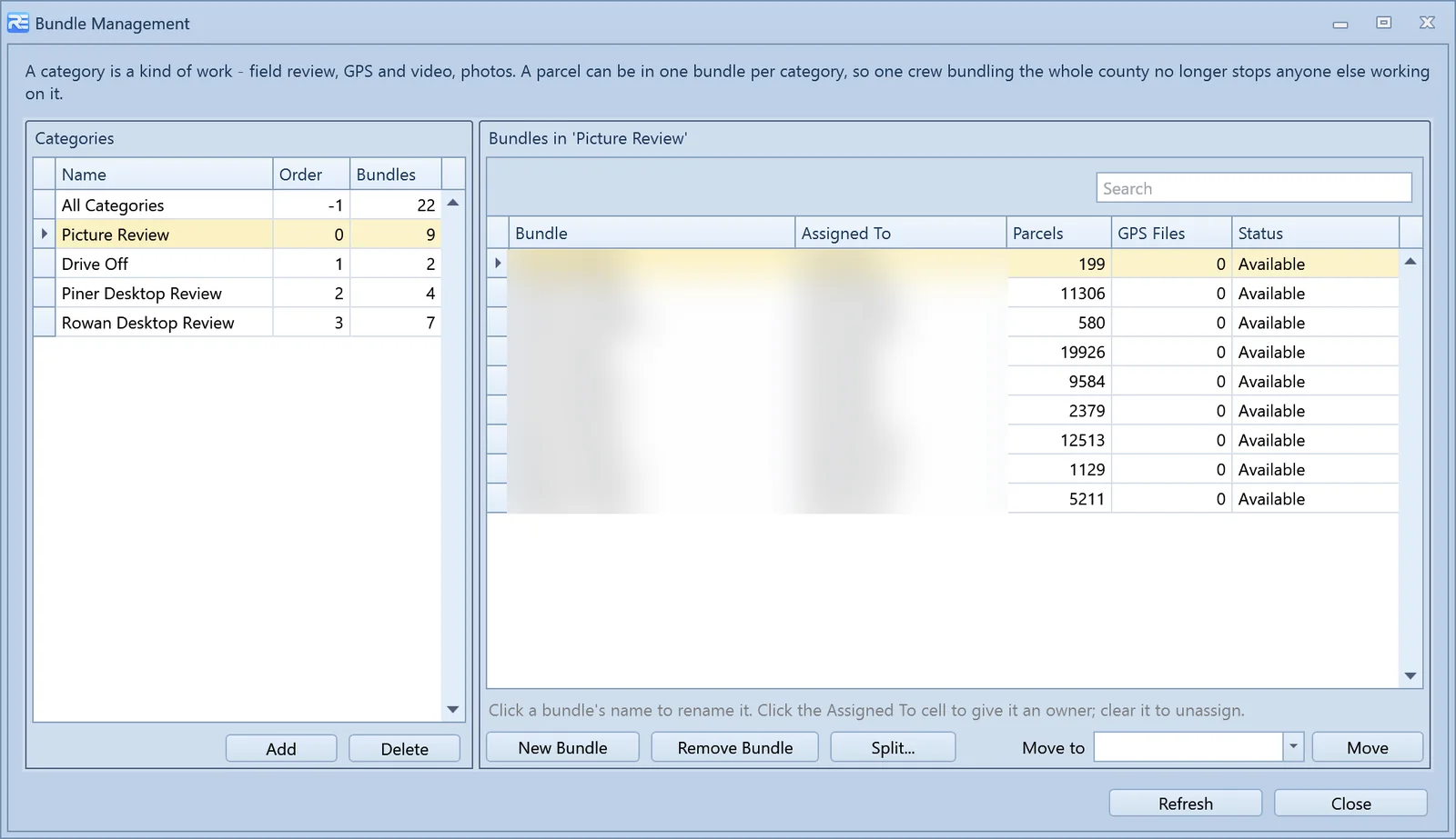
Bundles turn a county into a week's work.
A bundle is a work packet: a defined set of parcels handed to a named field user. Categories keep kinds of work apart — field review, picture review, drive-off — so one crew bundling the whole county for photos doesn't stop anyone else working it.
- Create bundles by selection, by pasting a parcel list, or by drawing on the map
- Split, move between categories, rename, reassign — while work is in progress
- Parcels missing from the county list are reported and added on request
- Export bundle contents and status to Excel
Review
QA without opening every card.
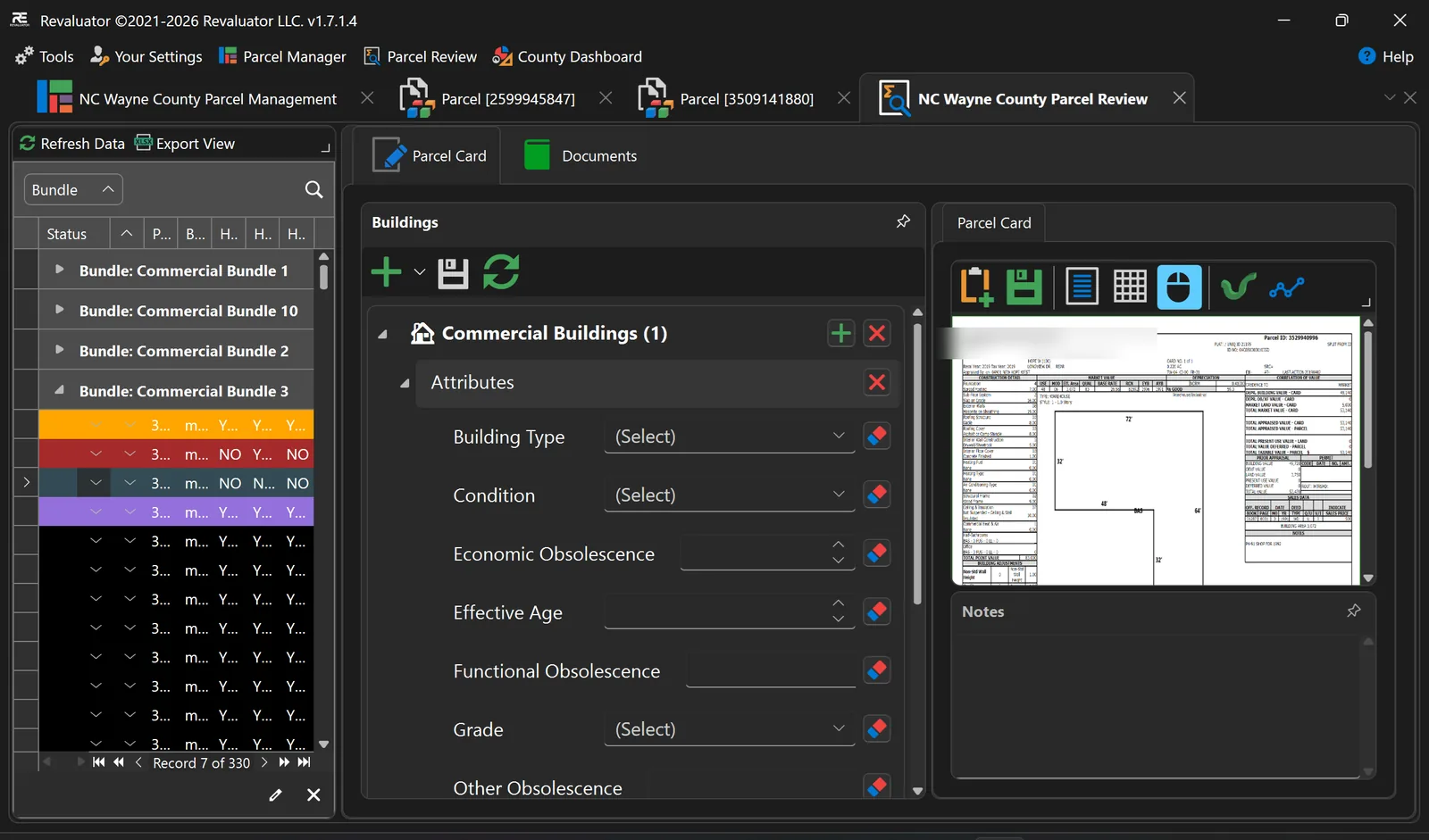
Parcel Review is the office's screen. Move through submitted work by bundle, open the parcel suite beside it — card, property record, documents, gallery — and accept or reject with the field user's imagery right there. Record edits get their own verdict, line by line.
- Review queues organised by bundle and status
- Approve or reject individual record changes; accept the field work, reject a line item
- Reject work back to the field user with a reason
- Change tracking so you can see what was altered, by whom and when
The parcel report
A parcel card, with everything behind it.
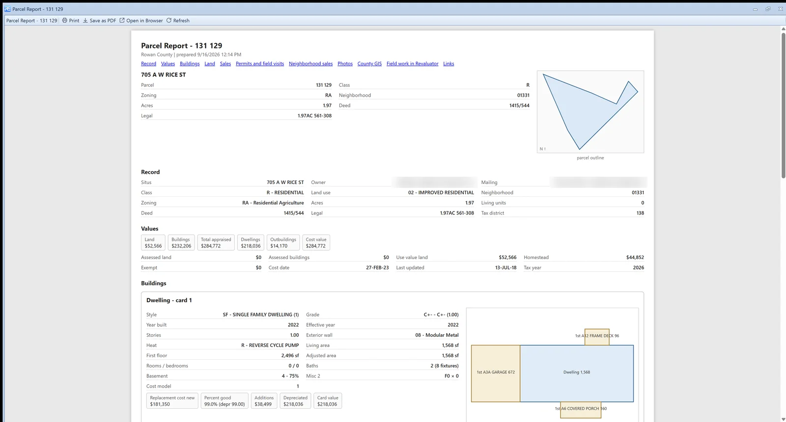
More Information on any parcel builds a single report page: identity and outline, values and roll history, every building card with its cost chain and a drawn sketch, land lines, sales, permits, field visits, photos, field work in Revaluator, neighbourhood sales and links. Print it, save it as PDF, or open it in the browser.
- Works for every county; a full CAMA extract adds the cost chain and sketches
- Values tied to the dollar against the county's own figures
- Pending record edits shown alongside the source record
- Deed, parcel page, Zillow, Street View and county links per parcel
Administration
Roles and permissions, one switch per feature.
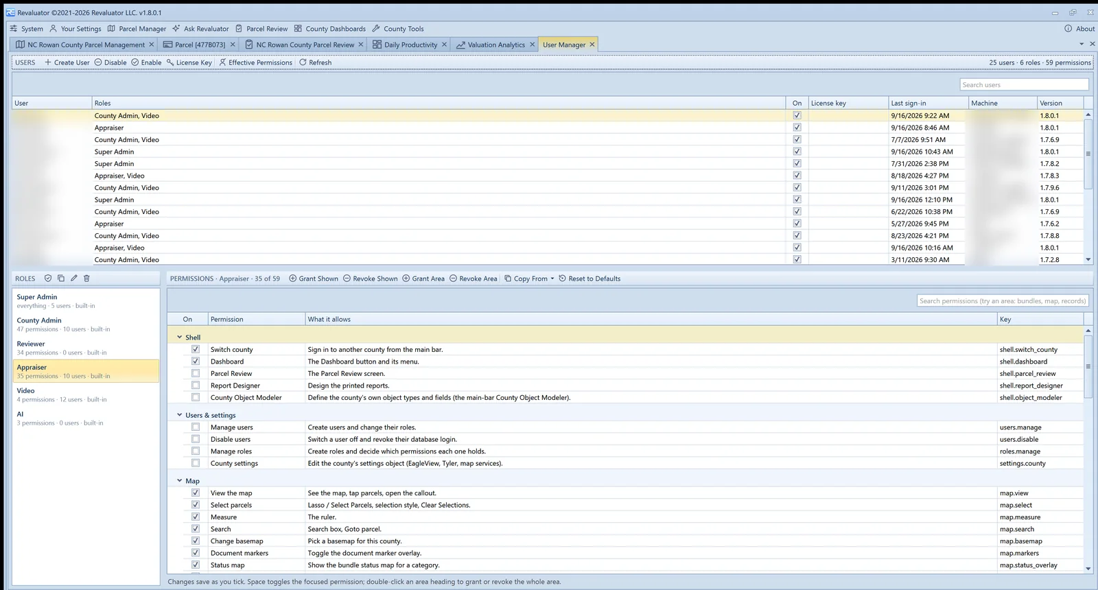
Six built-in roles — Super Admin, County Admin, Reviewer, Appraiser, Video and AI — or your own. Every feature in the app is a permission, grouped by area, and the assistant is bound by the same set as the person using it. Licence keys per user, disable and enable, last sign-in and machine on the grid.
- Users on top, roles and their permissions underneath
- Grant or revoke a whole area, copy a role, reset built-ins to defaults
- Effective permissions per user with the role that provides each one
- Rights resolve at sign-in and refresh when a role changes
Everything else
The full feature list.
Mapping & data
Shapefile import, parcel data import and browsing, map geometry selection, shape measurement, status maps per work category with configurable colours, basemap choice per county and user, and a parcel callout that puts every tool a parcel needs on one bar.
Layers & services
One grouped layer grid with draw order, opacity, styling and per-layer info and data browsing; county-shared and personal map services; a catalog of state, county and ArcGIS Online sources; shapefiles, KML, GeoPackage and rasters from disk.
Field & GPS
GPS support with live tracking and logging, follow and centre modes, breadcrumb trails, and bundle GPS auditing that proves a route was actually driven.
Routing & navigation
Parcel routing with turn-by-turn navigation, route setup per bundle, and drive-order planning so a day in the field follows the map instead of fighting it.
Video & imagery
GPS video with telemetry, frame stepping and still capture, a video repository, phone photos by QR code and Bluetooth, an image editor, and per-parcel galleries with EagleView obliques and Street View.
Valuation & analysis
Comparable sales with scored results and per-comp reports, the valuation sandbox, repeat-sales time adjustment, IAAO ratio studies, sales chasing tests, commercial and land analysis, sales verification, permit review, and county-editable rules.
Property record & sketch
Full editing of dwellings, additions, outbuildings, commercial sections and land wherever the CAMA publishes a full extract, with the county's code tables, learned field checks, a native sketch editor, offline round-trip and line-item review.
Ask Revaluator
An in-app assistant with around 150 tools over the live map, bundles, layers, video, analytics and property records — voice input, chat history, and the user's own permissions. Details.
Review, audit & history
Office QA queues by bundle and status, accept and reject with reasons, line-item verdicts on record edits, status change history, and change tracking that shows what was altered, by whom, and when.
Documents & parcel cards
Attach any file type to a parcel — deeds, permits, correspondence — with built-in viewers for documents, spreadsheets and county property record cards, including card markup tools.
Offline mode
Take a bundle to the field with no connectivity: a local working copy of parcels, data, county settings, downloaded layers and record edits, checked back in when you're online — all-or-nothing, so nothing is lost.
Dashboards & reporting
County dashboards for productivity and progress, a dashboard designer for building your own, the parcel report, analysis reports and appeal packs, and a report designer for county-specific outputs.
Administration
Roles and permissions, licence keys, a separate admin console for county settings, map services and catalog sources, and one settings object per county that grows with the product.
Counties without a CAMA
For a municipality with no usable system of record, a county object modeler defines object types, field schemas and picklists so Revaluator can be the record.
Integration & automation
Deep CAMA integration where a full extract is published; building and image updates elsewhere; scheduled import and export routines; county-specific customisation.
CAMA integration and county-specific customisation are development work. They're scoped against the system you already run and the way your office works — see what we already connect to, and talk to us about anything you don't find there.
Want to see it against your own data?
We'll load a slice of your parcel data and walk your team through the workflow end to end.