
Integrations
We don't ask you to replace what already works.
Your county already has a system of record, a GIS department and a state portal full of data. Revaluator is built to sit alongside them — reading the record you keep, staging the field work and the valuation, and handing only the approved results back to the systems you're keeping. It never writes to live data on its own.
DEEP Any CAMA with a full extract
The county's record, read the way the county reads it.
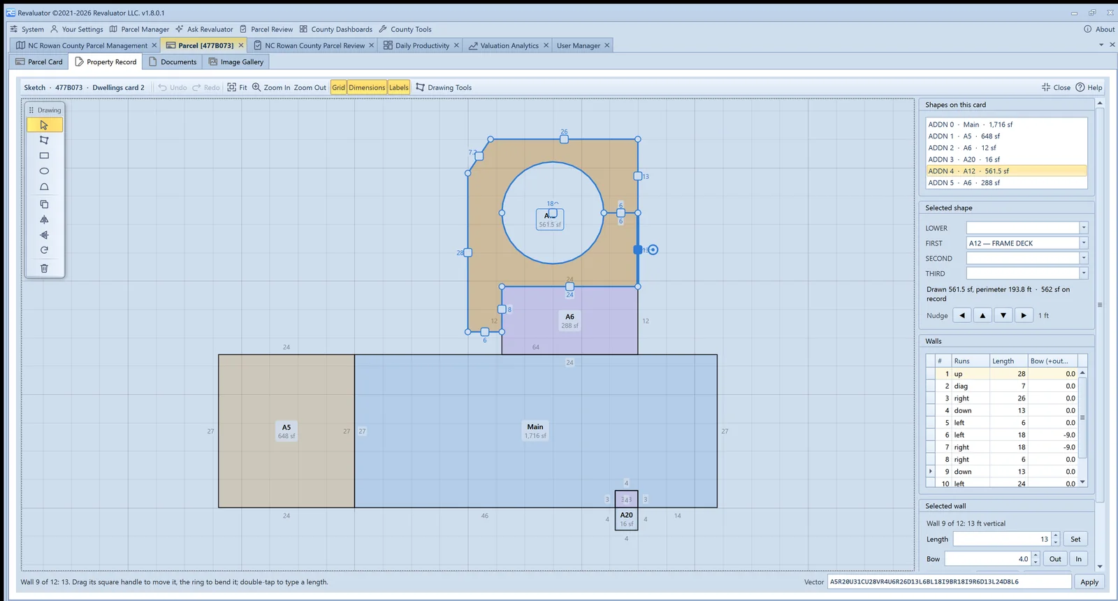
Where the CAMA system publishes a full extract — parcels, dwellings, additions, outbuildings, commercial cards, land, sales, permits, values and the county's own code tables — Revaluator loads all of it and fits the county's cost schedules from its own data. Every dwelling ties to the dollar. From there the record is editable, the sketch is editable, and every analytics tab runs on the real thing. We work with any provider; the depth depends on what the system exposes.
- Property record editor with the county's picklists, learned field checks and a change log
- Sketch editor that reads and writes the CAMA's own vector strings
- Comps, sandbox, ratio studies and sales chasing on the county's own sales and costs
- Edits stored on the county server, reviewed line by line, and staged for return in the form the CAMA accepts
CAMA systems
Field work belongs in your system of record.
Approved building data, values and imagery flow back into the platform your county already runs, through an integration built against it — your system of record stays exactly that.
Tyler Technologies
Parcel, building, sketch and imagery integration with Tyler's appraisal and tax products, scoped to the extract the county receives.
BI-Tek CAMA
Building and image updates written back into BI-Tek, so field work lands in the system of record.
Keystone
Parcel and building data exchange with Keystone, kept in step through scheduled routines.
Farragut
Import and export routines matched to Farragut's data structures and county workflows.
OneTax
Parcel and assessment data exchange with OneTax, so field results reach the tax office without re-keying.
GIS
Your state's data and your county's, in one catalog.
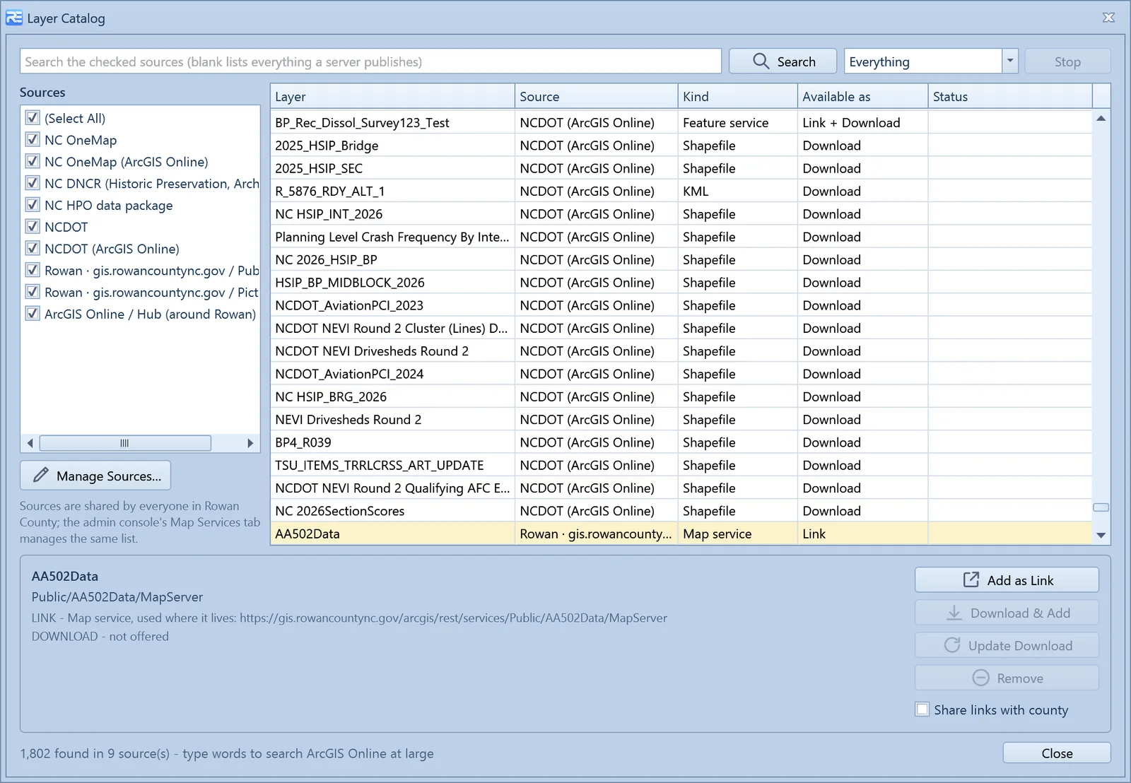
The Layer Catalog talks to ArcGIS servers, ArcGIS Online organisations and Hub sites, published feeds, download pages and plain folders. Each state ships with its portals seeded; each county adds its own GIS server once and everyone in the office sees it.
Esri ArcGIS — Basemaps, parcel layers and shapefile import; any ArcGIS Server, ArcGIS Online organisation or Hub site as a catalog source; features on linked services clickable on the map.
State GIS portals — Each state's portals seeded into the layer catalog - in North Carolina, NC OneMap, NCDOT and the DNCR historic-preservation and archaeology data - linked live or downloaded for offline.
County GIS servers — Point the catalog at your county's own REST root once and every service it publishes - aerials by year, zoning, schools, roads - is there for the whole office.
Sketching
Keep your sketches where they are.
Where the CAMA exposes its sketch vectors Revaluator edits them natively. Elsewhere it opens the package you already use.
Apex Sketch — Open, view and change sketches without leaving the parcel record on counties whose CAMA doesn't expose its vectors.
AI
The assistant, and what it runs on.
Language model provider — Ask Revaluator runs on a leading commercial language model, with tools that call the application's own code, a permission set that follows the signed-in user's role, and an off switch per county and per role.
Imagery
More angles than a drive-by gives you.
Revaluator captures its own street-level video and phone photos, and pulls in third-party imagery for the views a vehicle can't reach.
Piner Imagery
Purpose-driven street-level imagery captured county-wide for assessment work - our preferred source for street views, shot for the appraiser rather than the motorist, and browsable per parcel beside the card.
EagleView
Aerial and oblique imagery per parcel with a compass to turn the view, plus roof and structure reports, browsable beside the parcel card.
Google Street View
Street-level reference imagery for parcels dedicated capture hasn't reached yet.
See how our own capture works on the street-level imagery page.
How it works
An integration is scoped, not switched on.
No two counties run the same configuration of the same product. We build against what you actually have.
We look at your setup
Which product, which version, which fields your county actually uses, and who owns the database.
We agree the data flow
What moves, in which direction, and when — buildings, sketches, imagery, parcel updates, status changes.
We build and test it
Against a copy of your data first, so you can see exactly what would be written before anything is.
It runs on a schedule
Automated import and export routines keep both sides in step for the rest of the cycle.
Don't see your system here? The list above is what we've already built, not the limit of what we can. If your county runs something else, tell us what it is — we'll tell you honestly what's involved.
For CAMA providers
Help your clients stay with you.
Counties rarely leave a CAMA system because of the CAMA. They leave because a reappraisal needed field tools, sketching, imagery, comps and ratio studies the system didn't have, and the search for those turned into a search for everything. Revaluator is that suite of tools, built on top of your system rather than instead of it — your record stays the record, and every change is staged and reviewed before it comes back to you.
If you build CAMA, appraisal, GIS, sketching or imagery products and want a documented, supported connection to Revaluator, get in touch. We'd rather build it with you than around you.
Want to know if we can connect to your system?
Tell us what your county runs today. We'll be straight with you about what integrating would take.