Street-level imagery
Drive the route once. Answer questions for years.
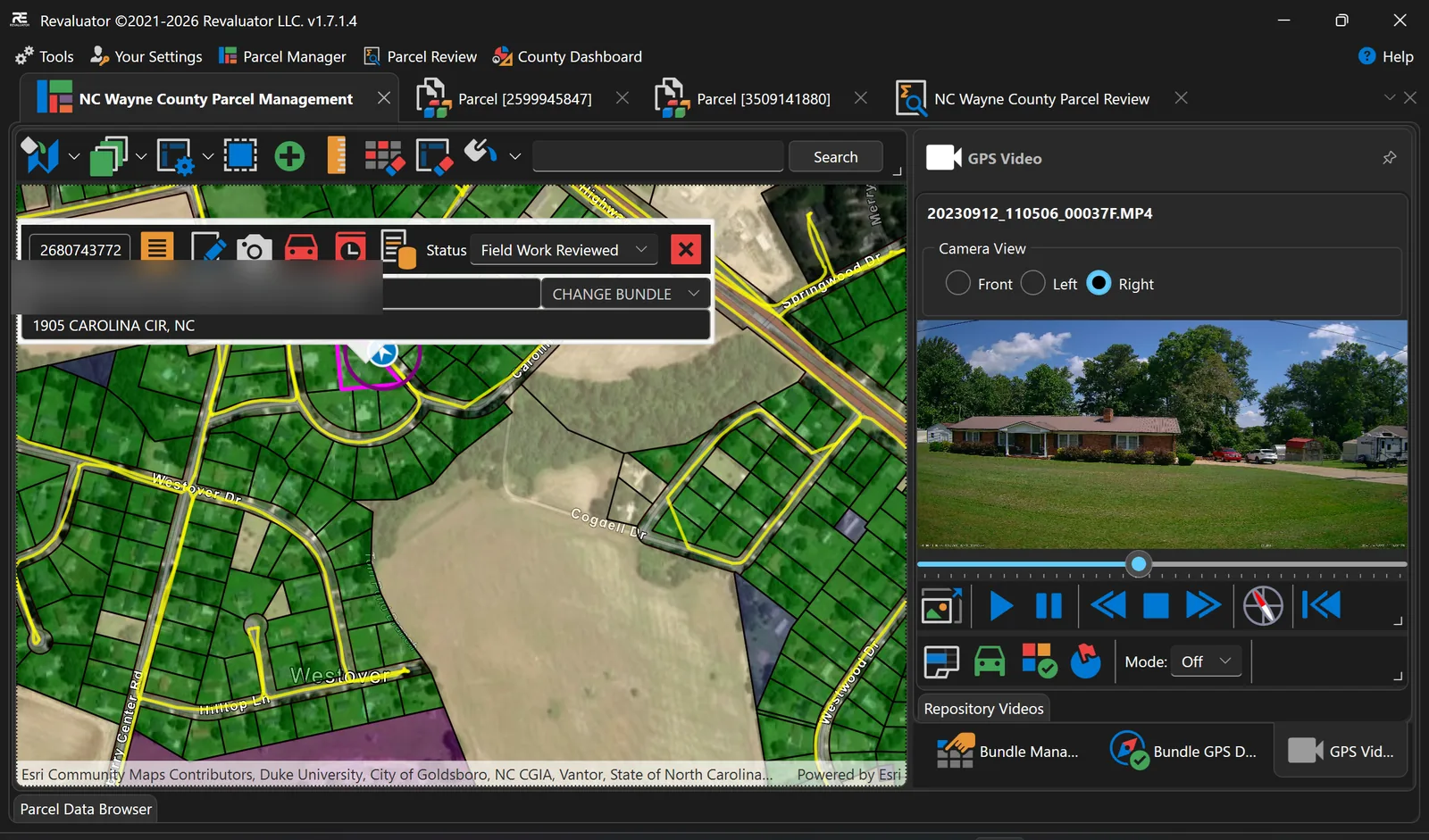
Revaluator captures continuous GPS-synchronised video from a vehicle, then ties every frame back to the parcel it belongs to. When a question comes up in review, the answer is already on screen — nobody has to drive out there again.
Capture
Video, not disconnected snapshots.
A vehicle-mounted camera records MP4 footage while telemetry records where the vehicle was and which way it was pointing. Because it's continuous video, you get the whole street — access, outbuildings, neighbouring structures, condition — not just whatever happened to be framed when the shutter fired.
- Front, left, right and rear camera views
- Telemetry recorded with the footage; driven routes drawn on the map
- Clips managed centrally in a video repository
- Local caching so field machines don't fill up
Review
Step to the frame, grab the still.
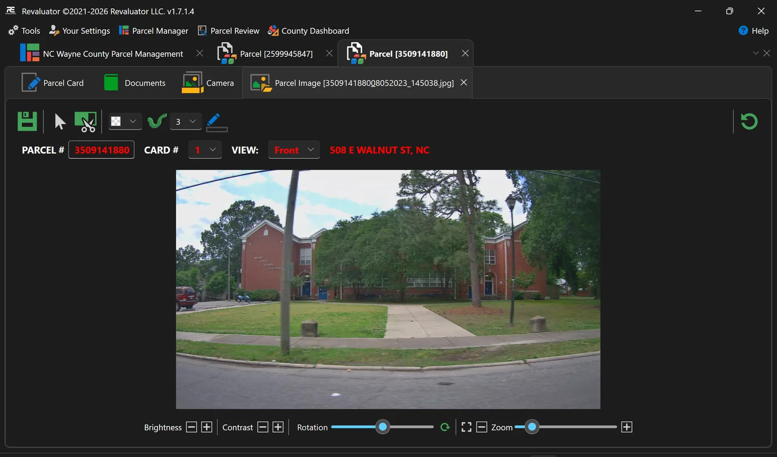
Play, pause, step frame by frame, jump between clips, and change playback speed. When you find the view you need, capture it as a still image and attach it directly to the parcel record — or ask the assistant for the best frame of a house and let it find the moment for you.
- Frame-accurate stepping and clip navigation
- Capture stills straight into the parcel's imagery, with the card and view labelled
- Crop, pen, brightness, contrast, rotation and zoom
- Ask Revaluator scores every camera by bearing and distance and shows the candidates
From the phone
Scan the card, take the photo, done.
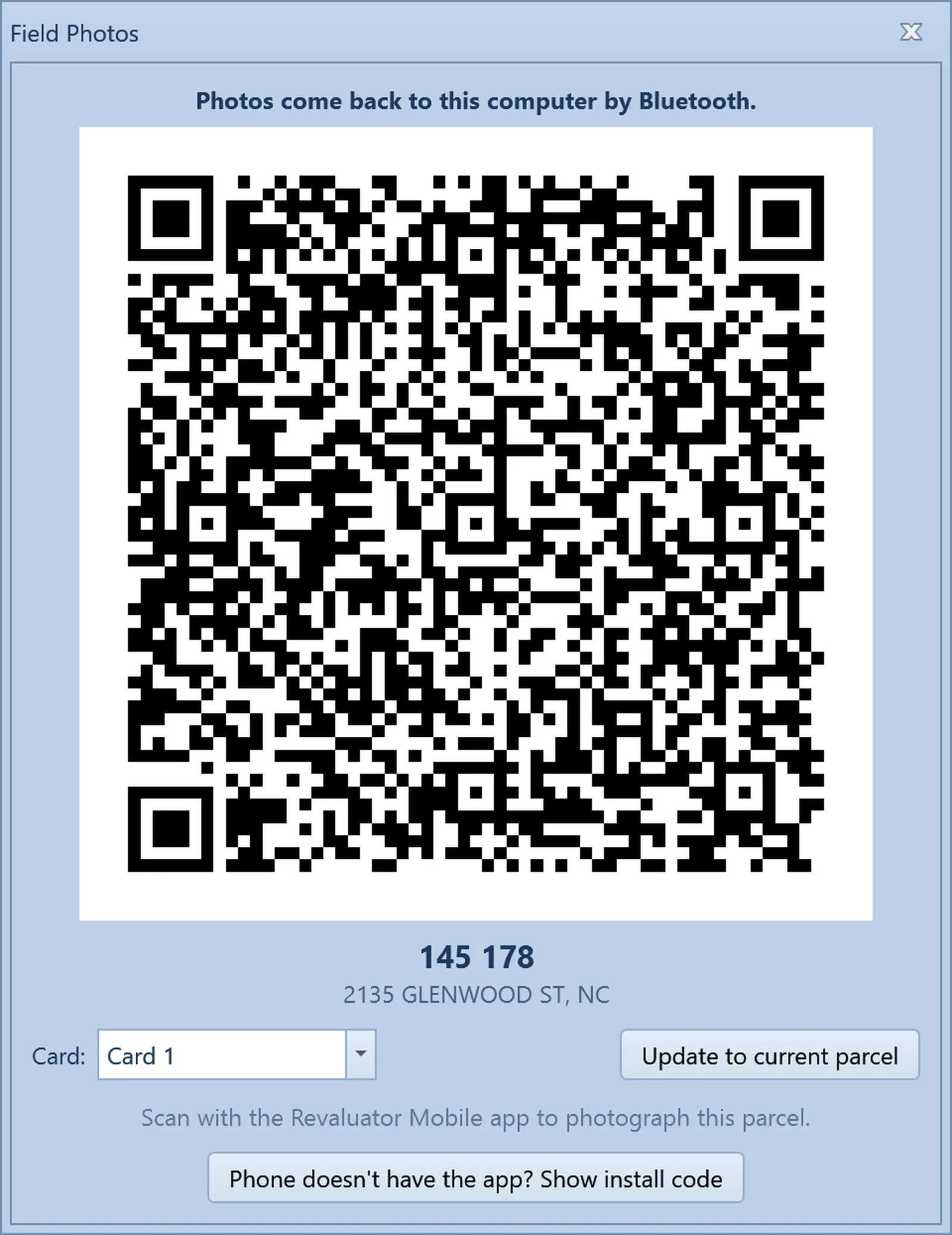
For the shot the car can't get, the parcel shows a QR code. Scan it with the Revaluator Mobile app on any Android phone, photograph the structure, and the picture comes back to the tablet by Bluetooth — already tagged with the parcel, the card and the view.
- No typing a parcel number on the phone, ever
- Works with no signal — the phone talks to the tablet directly
- Photos land in the parcel gallery and on the property record
- The app installs from a code on the same screen
From above
Aerial and oblique imagery too.
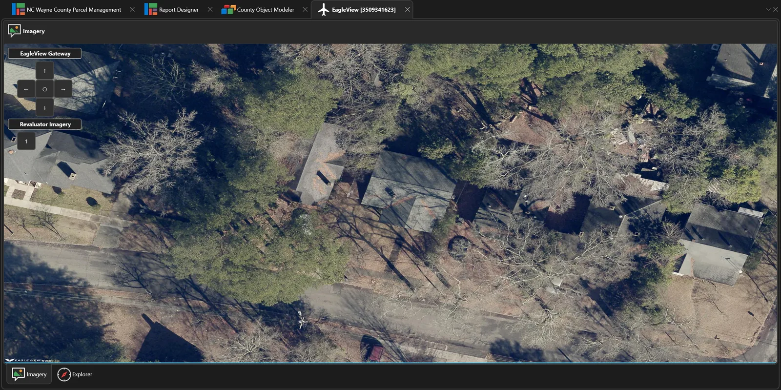
Street level tells you about the front of the property. For roofs, footprints and anything set back from the road, the parcel gallery carries EagleView obliques with a compass to turn the view, straight-down imagery, the field photos, and Google Street View — all on the parcel's own tab.
- North, south, east, west and straight-down per parcel
- Field photos beside the obliques; a numbered strip when there are many
- Historic county aerials and state orthoimagery as map layers from the catalog
Why it matters
Fewer trips, better defensibility.
One pass, not three
Most re-visits happen because a detail was missed, not because the property changed. Continuous footage means the detail was captured whether anyone thought to look for it or not.
Evidence for appeals
Dated, position-stamped imagery of the property as it stood on the day it was valued — retrievable when a taxpayer challenges the assessment.
Proof of coverage
GPS breadcrumbs and bundle GPS auditing show which roads were actually driven, so gaps in coverage surface before the deadline does.
Don't have crews to drive it?
Piner Imagery runs street-level capture for assessment work — the vehicles and crews that produce the footage Revaluator's GPS video system consumes.
See the imagery workflow in action.
We'll walk you through capture, review and how stills end up attached to a parcel record.